Here is a comprehensive rundown of all of the locations that Mosh embarks to during their trips with history, information, and amazing facts! Enjoy
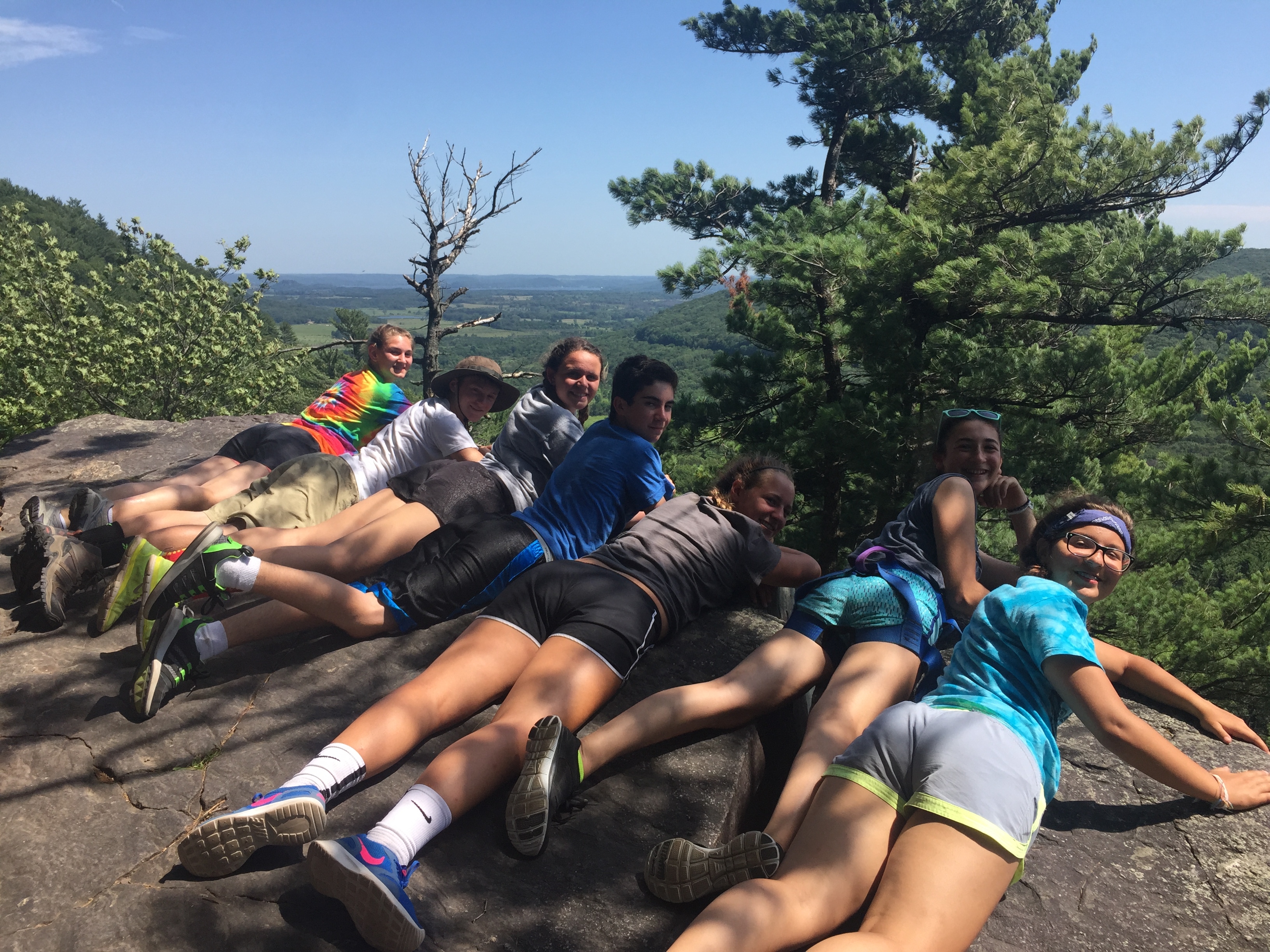
Hiking Bet – Kettle Moraine Southern Unit/Ice Age Trail
by Rachel Mintz
History:
The original inhabitants of this land were the Hochunk nation. For this tribe, the land was sacred because it provided all their needs: food, clothing, shelter, and water. In 1643 the Hochunk people began trading with Jean Nicolet, a French trader, and Marquette, a missionary. This continued for about 150 years, until the settlers reached what today we know as Wisconsin. In 1783, after the Revolutionary War, the US claimed ownership of Wisconsin, even though several Native American nations were already living there. In 1836, this land was taken from the Hochunk for a small sum of money, to be used by settlers for farming and mining. The Hochunks were forcibly moved to northern Minnesota, where they acted as a buffer between the Ojibwe and Dakota tribes, enduring attacks from both sides. They asked the US to let them move to better land along the Mississippi River, but were moved Westward, and their reservation was reduced from eighteen to nine square miles.
Environment:
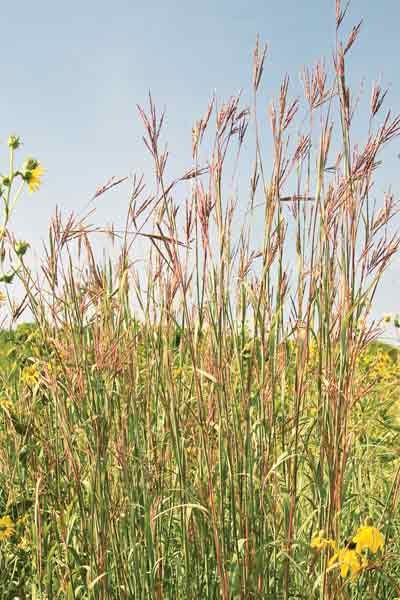
We hike two distinct areas during this trip: the Scuppernong Prairie and the Kettle Moraine Low Prairie. The Scuppernong Prairie is the largest wet prairie east of Mississippi River. The Scuppernong Prairie includes a lot of wet-mesic prairie species. Plants include big blue-stem, Indian grass, needle grass, blue-joint grass, prairie drop-seed, Virginia mountain mint, cream wild indigo, shooting-star, lead-plant, compass plant, prairie dock, blue-eyed grass, prairie smoke, and prairie blazing-star, as well as the rare purple milkweed, prairie Indian plantain, and marsh blazing star. In the center and eastern side are open-grown bur oaks, which are typical of presettlement times. This prairie is a perfect habitat for uncommon birds such as boblink, western meadowlark, and upland sandpiper. Other uncommon animals include Franklin’s ground squirrel, badger, and eastern hognose snake. Scuppernong Prairie is owned by the DNR and was designated a State Natural Area in 1952. (https://dnr.wi.gov/topic/parks/name/kms/nature.html)
The Kettle Moraine Low Prairie is in the center of the Scuppernong Basin, and once had a vast prairie and meadow. Plants include: blue-joint grass, shrubby cinquefoil, valerian, grass-of-Parnassus, and the uncommon Ohio goldenrod. In the prairie closer to the river, typical plants include Indian grass, big and little blue-stem, rattlesnake-master, and prairie dock. Islands within the wetland contain recovering oak opening and prairie. This area has large populations of rare plants and animals and acts as a refuge for them. These include prairie Indian plantain, marsh blazing-star, the state-endangered Powesheik skipperling, state-threatened Butler’s garter snake, and Henslow’s sparrow. Other rare animals include the two-spotted skipper, grasshopper sparrow, upland sandpiper, northern harrier, and western meadowlark. (https://dnr.wi.gov/topic/Lands/naturalareas/index.asp?SNA=88)
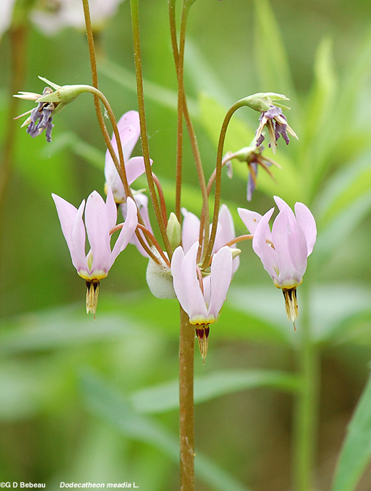
Shooting Star
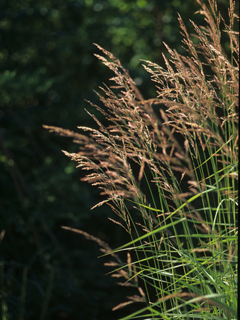
Big Blue Stem Grass
Rattlesnake Master
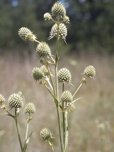
Ohio Goldenrod

Blue Joint Grass
The Wisconsin River
(Canoeing Bet, Please read please enjoy. Love Ari Gershon & Mady Frischer)
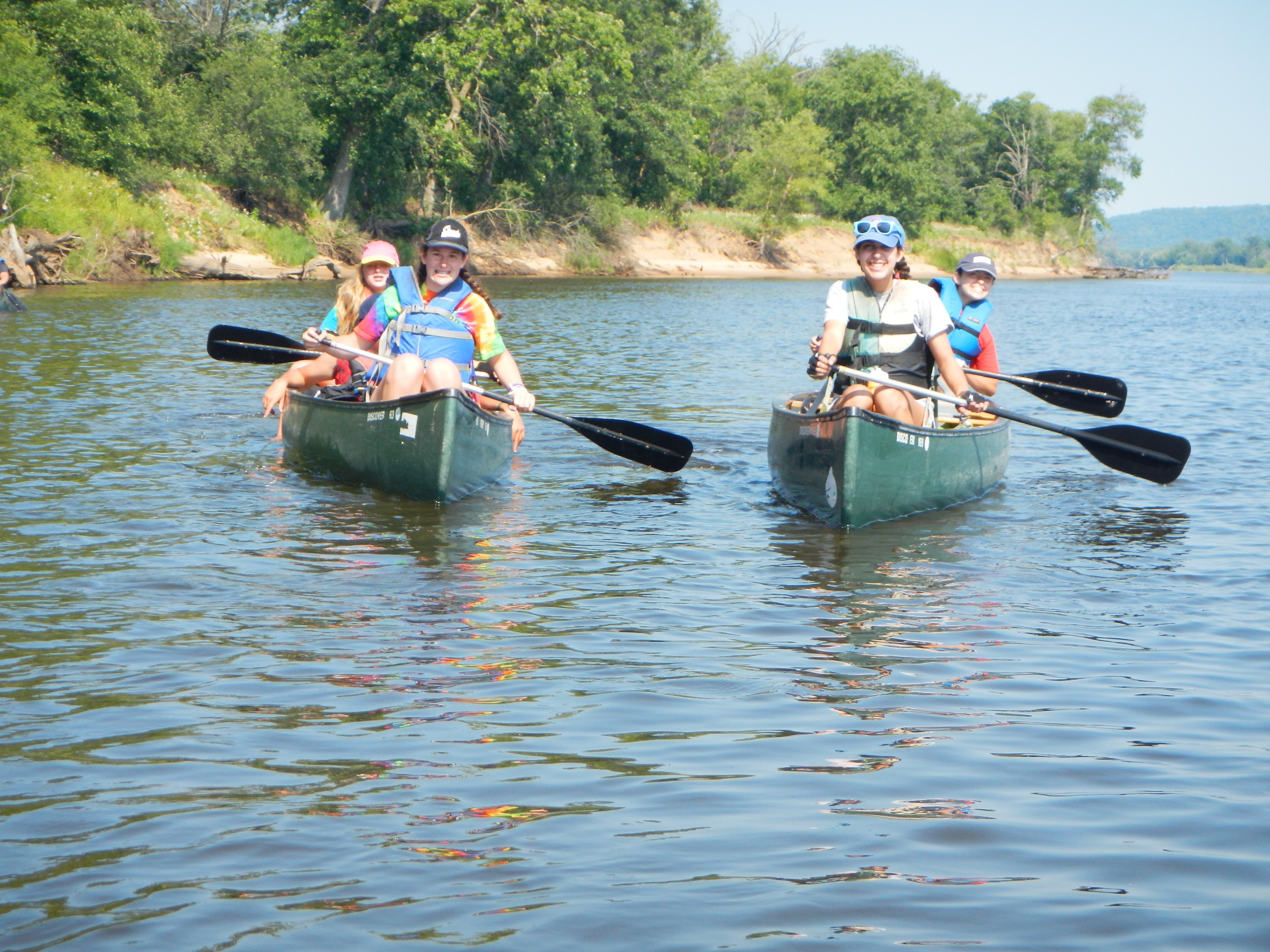
HISTORY
The Wisconsin River is super cool. Its original name was “Meskousing,” and was discovered in 1673 by Jacques Marquette. The original meaning is described as “obscure” on the internet. Later French explorers renamed it “Ouisconsin” which is just a bougie way to write “Wisconsin.” The name of the river led to many different and weird looking spellings of “Wisconisn,” including, “Wiskonsan.” The Wisco river is a tributary of the Mississippi River. It is about 430 miles (692 km) long, making it the state’s longest river. It flows from northern Wisconsin, near the Michigan border, down to the Wisconsin Dells! In Lincoln County, the river forms its largest waterfall, Grandfather Falls. Great name for a waterfall, terrible thing to actually happen. There are many fun, flirty, and quirky cities along the mighty wisco, including, but not limited to, Wausau, the hometown of our mighty Rosh Eidah, Eli Danson!
TEVA NATURE TEVA “CLAP!”
A long long time ago, in a land not so far away glaciers moved across and formed the incredible Wisonsin River that we love and know today. But, let me tell it to you straight, yes you are tough mosh campers but, no you cannot canoe the whole river in 4 days because the river is v. long I’m talking 420 miles! Also the portion flowing North West jkjk just west but that’s a baby’s name (crazy right!) anyhoo the portion flowing west is MILLIONS of years older than the rest of the river this area is called the “Driftless Area”. People also believe that the river used to flow East, and sometimes according to great mosh trip legends on VERY windy days you can still see the river flow East. So keep your eyes peeled and look for the beautiful nature that the glaciers created a solid 15,000 years ago.
That’s all for now folks stay tuned for more cool info from all your fave staff!
Devil’s Lake: Rock Climbing
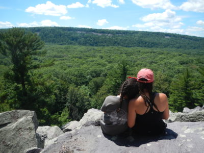
Devil’s Lake State Park was founded in 1911, as part of the creation of Interstate State Park along the St. Croix River, followed in 1909 by Peninsula State Park and then Devil’s Lake State Park two years later.
The first people at the lake probably date back more than 10,000 years; clear evidence shows use of a shelter at what is now Natural Bridge State Park and at the Durst rock shelter soon after the last ice age. Both are within a day’s walk of Devil’s Lake. The first irrefutable evidence of people at the lake points to a fascinating enigma: the mound builders of about 1000 years ago. They left effigy, linear and conical mounds behind. To this day, the speculation of historians is widely dispersed among several theories about their long lost culture. Historic era Native Americans frequented the lake, but did not inhabit the valley on a long term basis. In 1832, John De La Ronde was the first non-Native American known to visit the lake. In 1849, naturalist and scientist Increase Lapham noted the lake: “a large body of broken fragments have accumulated along the edge of the water rendering it very difficult to walk along shore: yet two of our party made a circuit of the lake, jumping from rock to rock as best they could.”
More recently, European immigrants and settlers took note of the lake in the mid-1800s. With the routing of a rail line through the lake valley, tourism began booming.
The boom of dynamite explosions echoed throughout the Devil’s Lake valley in the late 1800’s. Quarries operated within a stone’s throw of the lake and another location about a half mile past the group camp area.
Work camps sprang up and trains hauled the shattered quartzite away. The quarries were last put to use in the 1930s when the Civilian Conservation Corp used quartzite stone to build the park headquarters, the Rock Elm shelter and the ranger headquarters.
During the hard times of the 1930s depression era, a Civilian Conservation Corps (C.C.C.) work camp was established inside the state park. From 1934 to 1941, about 200 young men worked on many projects that continue to benefit the park even to this day. They built trails in some of the most rugged parts of the park, removed invasive species, guided visitors onto the bluffs, built tables, signs and benches, built a reservoir, relocated roads, patrolled the bluffs as fireguards and built at least three stone buildings.
Mosh Bet Biking Trails:
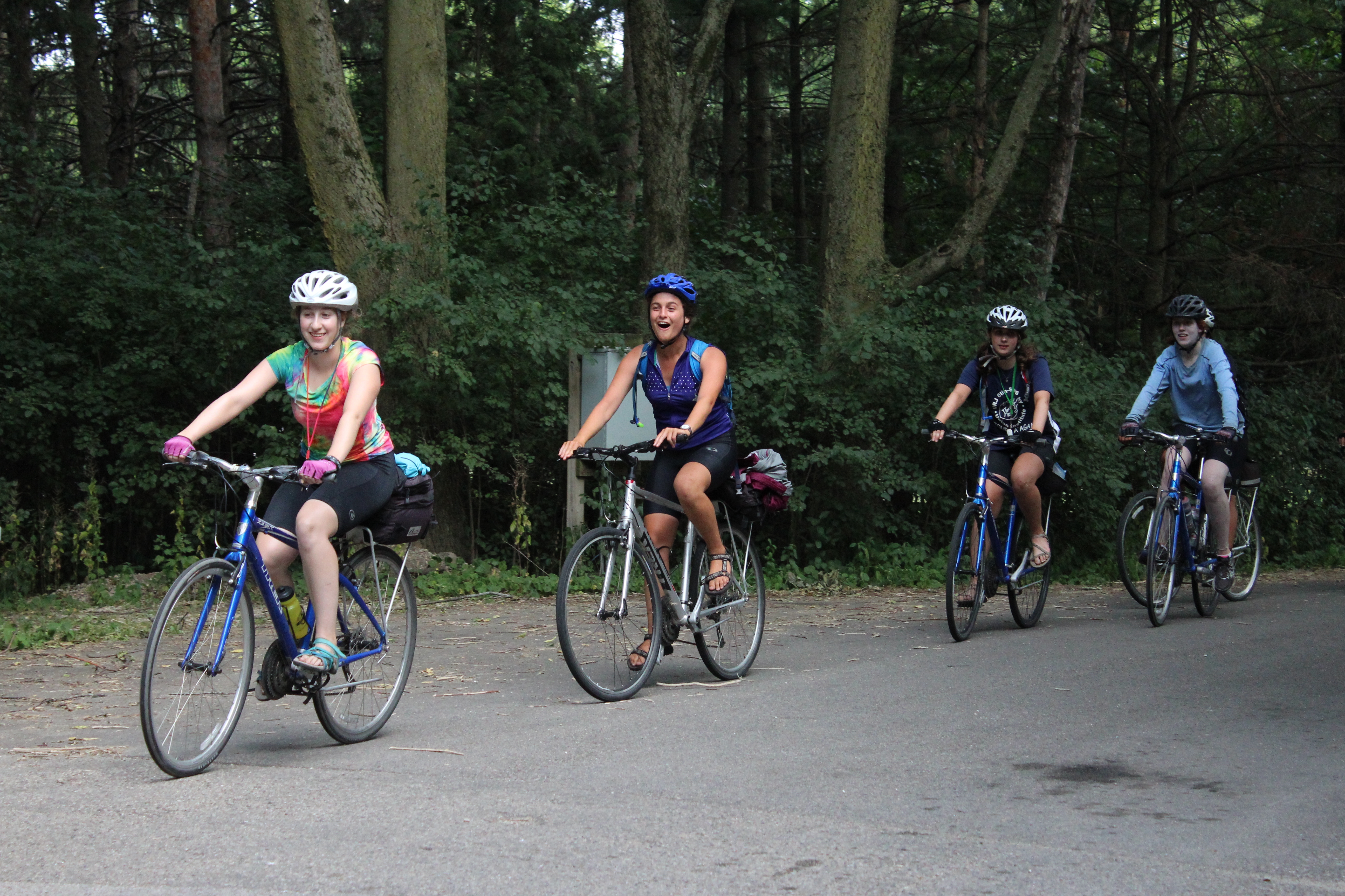
by Ethan Goldish
The Elroy- Sparta Trail was first two tunnels drilled through 1,680 feet of rock. The third tunnel was drilled through 3,810 feet. It was the first rails to trails conversion in the country. Chicago and the North Western Railroad line between Elroy and Sparta stopped operating in 1964. The right of way was purchased by the old Conservation Department in 1965 for $12,000.
In Wisconsin, there are now 21,000 miles of trails on former railroad tracks, many of which have been built over the past fifty years. When a railroad is abandoned, it impacts the community by decreasing business income, tax revenue (things supplied to the community), the number of businesses, etc. Furthermore, an abandoned railroad can be grown over, but impacts the environment, which will never be the same after the building of the tracks… So building trails over tracks allows for less environmental impact when the tourism/travel industry decides it needs more trails, and it allows us to experience the teva!
The average annual visitor attendance on the Elroy-Sparta Trail is more than 60,000 people. The total length is thirty-two miles, which has been ridden by many greats, including President Harry S.Truman. Sparta, Wisconsin is the biking capital of the world. The trail is home to many exciting attractions such as a thirty-two-foot tall fiberglass statue of a man on a Victorian era bicycle named Ben BIkin’. The area is also home to a large Amish population, which gives us an opportunity to learn about a unique culture. There are six towns scattered throughout the trail: Elroy, Kendall, Wilton, Norwalk, Ontario and Sparta.
https://vimeo.com/170063169